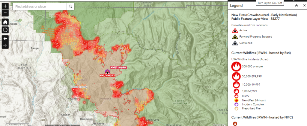
The 2MCFire Monitoring Center provides real-time visualization of insured property exposure during an active wildfire event. Regular updates from our incident response teams ensures that our mapping data accurately reflects policy points relative to changing wildfire conditions, including dynamic fire behavior and threat perimeter adjustment.
By combining our latest GIS software with real time data, our analysts can generate meaningful threat–perimeter models highlighting at-risk insured properties. This monitoring provides critical information on wildfire events including potential insured-loss exposure.
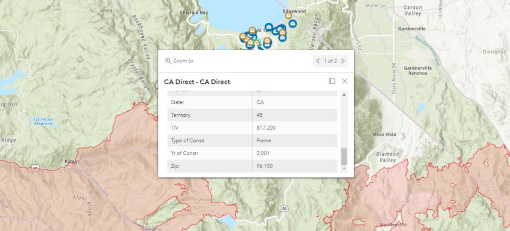
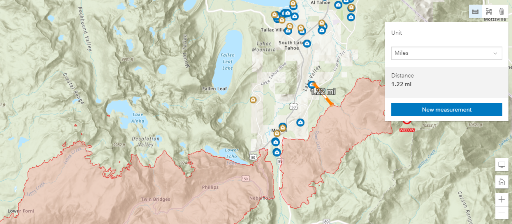
Once a customer becomes a client, we import their assets into our mapping platform. Once in the platform we can monitor for various hazards, including, flooding, wildfire, hazardous vegetation and fire history. The listed assist with monitoring or identifying risk, that allow for mitigations, including an emergency response.